บทพิสูจน์
ความสามารถ
ตามหลักฐานทางประวัติศาสตร์..บริเวณที่ราบสูงในภาคตะวันออกเฉียงเหนือเป็นชุมชนเก่าแก่กว่า 5,000 ปี การดำเนินชีวิตในสภาพพื้นที่อันมีข้อจำกัด ทำให้คนในพื้นที่เรียนรู้ที่จะปรับตัวในการดำรงค์ชีวิตจึงมีหลักฐานการทำกิจกรรมทางชลประทานและกสิกรรม ไม่ว่าจะเป็นร่องรอยการขุดคูน้ำ สร้างคันดินรูปแบบที่แตกต่างกัน และหลักฐานประดิษฐ์อุปกรณ์และเครื่องมือในการดำรงค์เลี้ยงชีพมากมายหลายชนิด
โปรไฟล์บริษัท
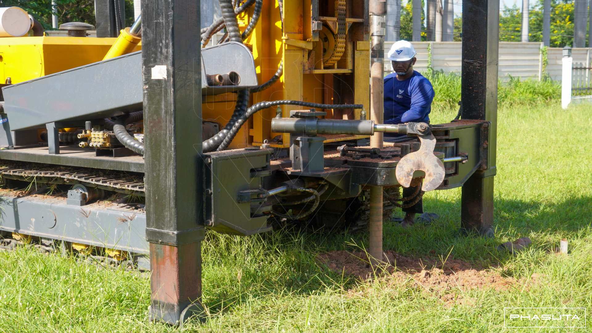
ท่ามกลางความแห้งแล้งกันดารของพื้นที่ภาคอีสาน..สกุลช่างเก่าแก่ในพื้นที่จังหวัดนครราชสีมาตระกูลหนึ่งได้เรียนรู้และเพิ่มพูนทักษะการแก้ไขปัญหาของทรัพยากรดินและน้ำจากรุ่นสู่รุ่น ด้วยองค์ความรู้ทางธรรมชาติวิทยาพร้อมทักษะเชิงช่างหลากหลายแขนงของครอบครัว ประสานกับการเลือกใช้เครื่องมือและอุปกรณ์อย่างชำนาญ
สืบเนื่องมาจนถึงปัจจุบันเรายังคงสืบสานสายเลือดนักสู้ของช่างฝีมือหลากหลายแขนงมาอย่างต่อเนื่อง ยังเรียนรู้ที่จะปรับตัวในการประยุกต์ใช้เครื่องมือเทคโนโลยีสมัยใหม่ในการประยุกต์ใช้การทำงานให้มีประสิทธิ์ภาพมากยิ่งขึ้น และจัดตั้งให้อยู่ในรูปแบบบริษัทที่มีการขึ้นทะเบียนพาณิชย์ถูกต้อง มีสถานประกอบการและโรงงานอยู่ใจกลางเมืองเพื่อให้ลูกค้าและคู่ค้าสามารถติดต่อได้สะดวก
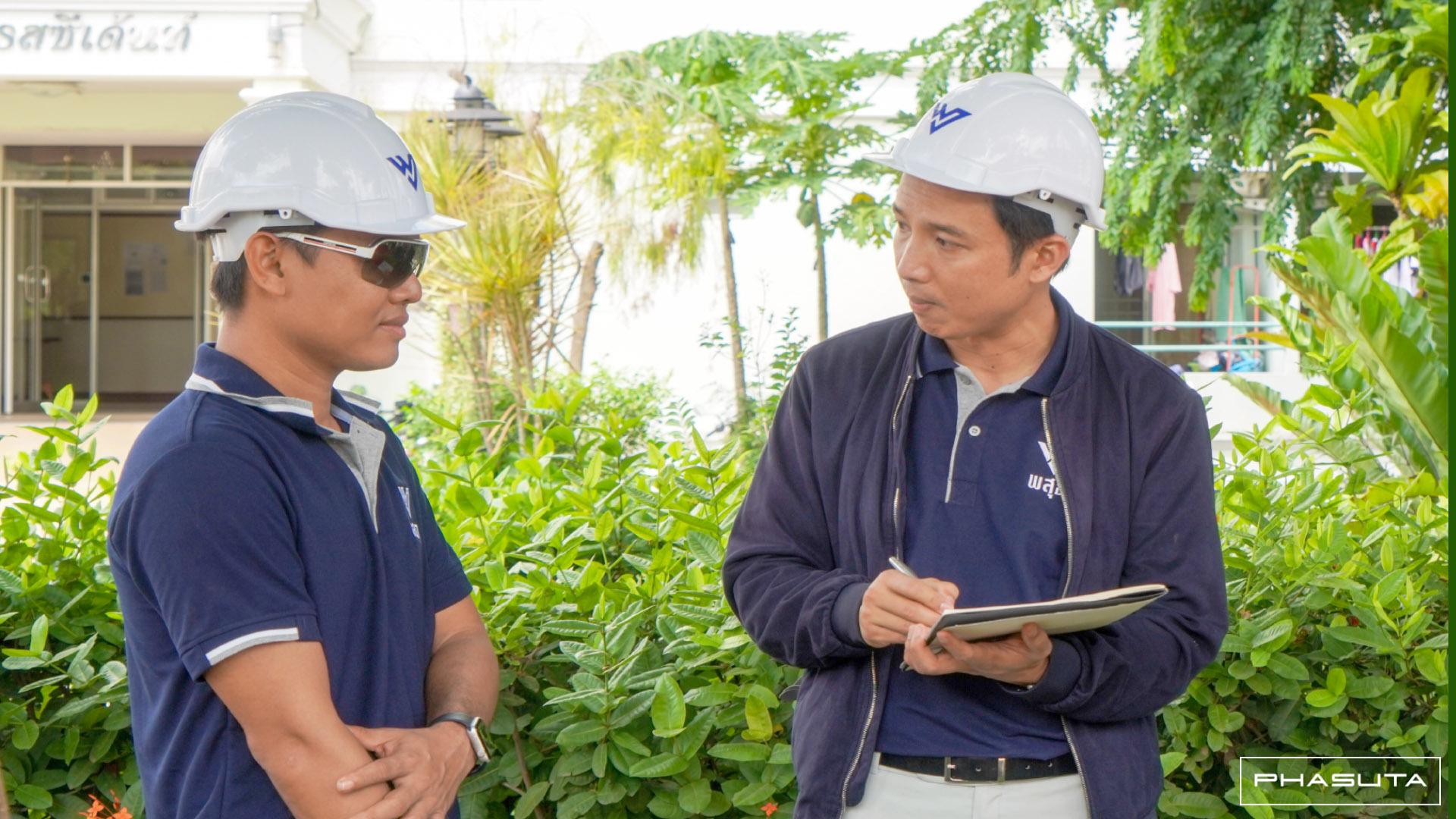
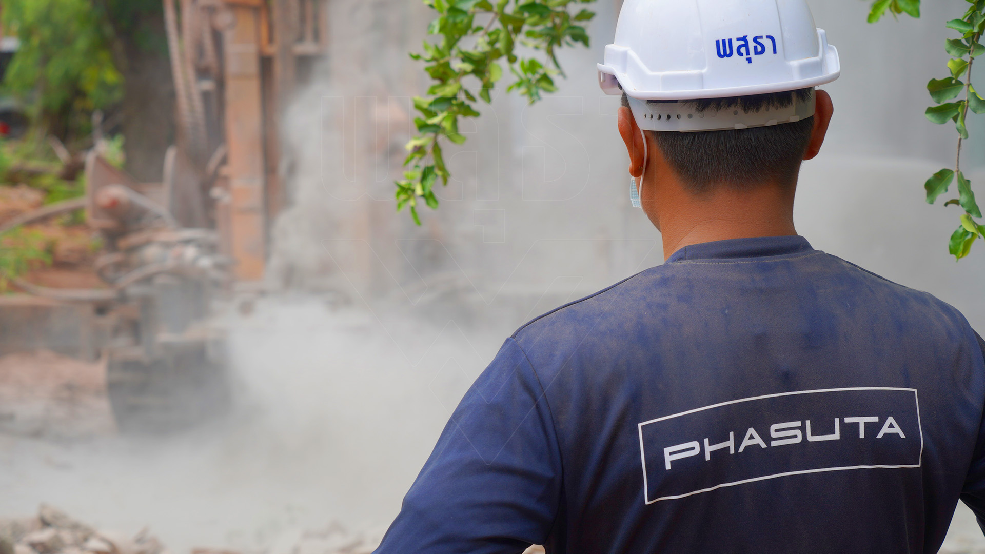
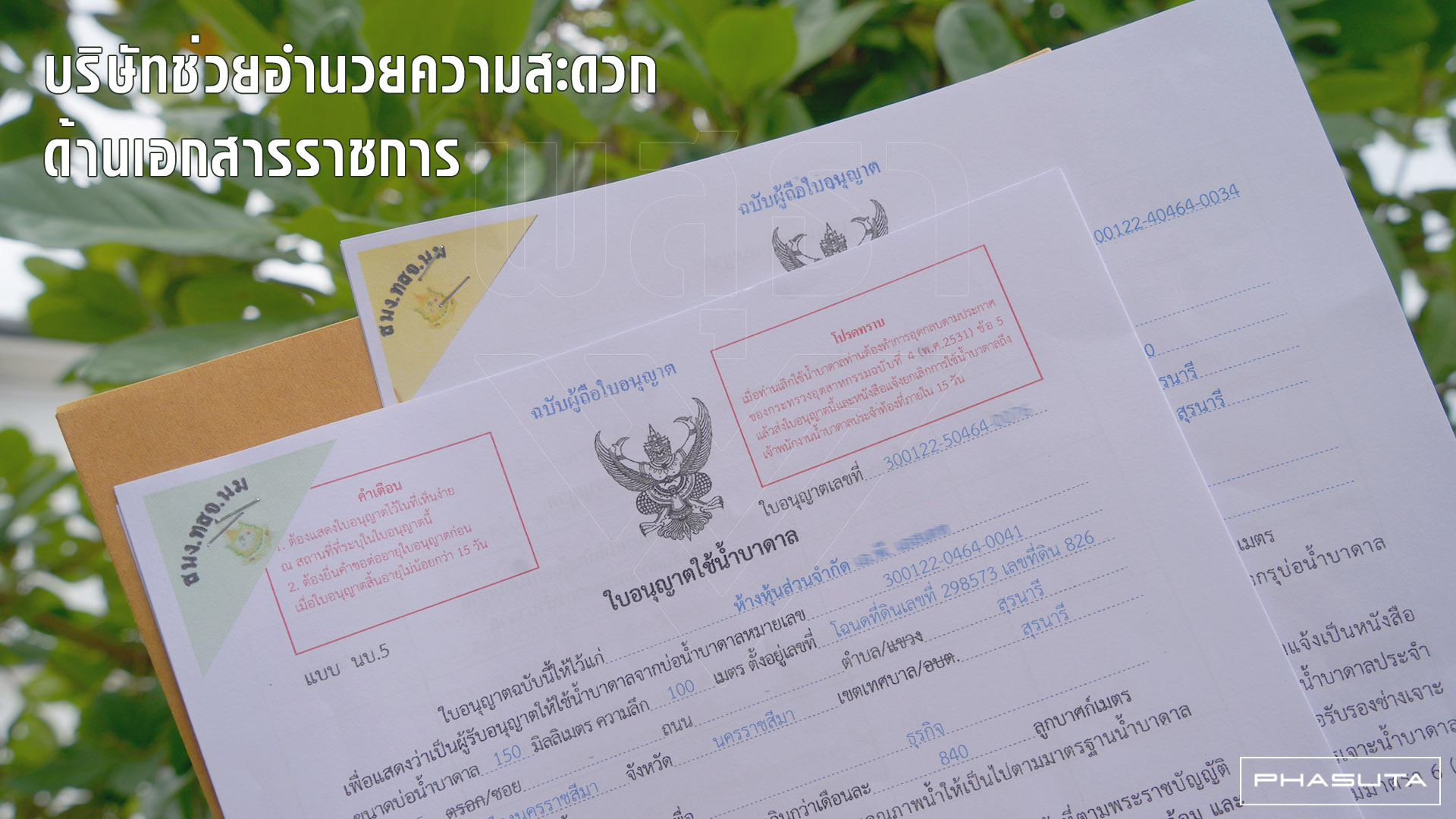
นอกจากนั้น บริษัทยังส่งช่างฝีมือเข้ารับการอบรมวิชาชีพจนได้รับใบอนุญาตฯ จากหน่วยงานต่างๆ อย่างถูกต้องอีกด้วย
ส่ิงที่ลูกค้าได้รับ
ซื่อสัตย์และจริงใจกับลูกค้า
เลือกใช้แต่ของและอุปกรณ์คุณภาพดี งานตรงสเป็ค-ไม่หมกเม็ด
มีความรับผิดชอบ
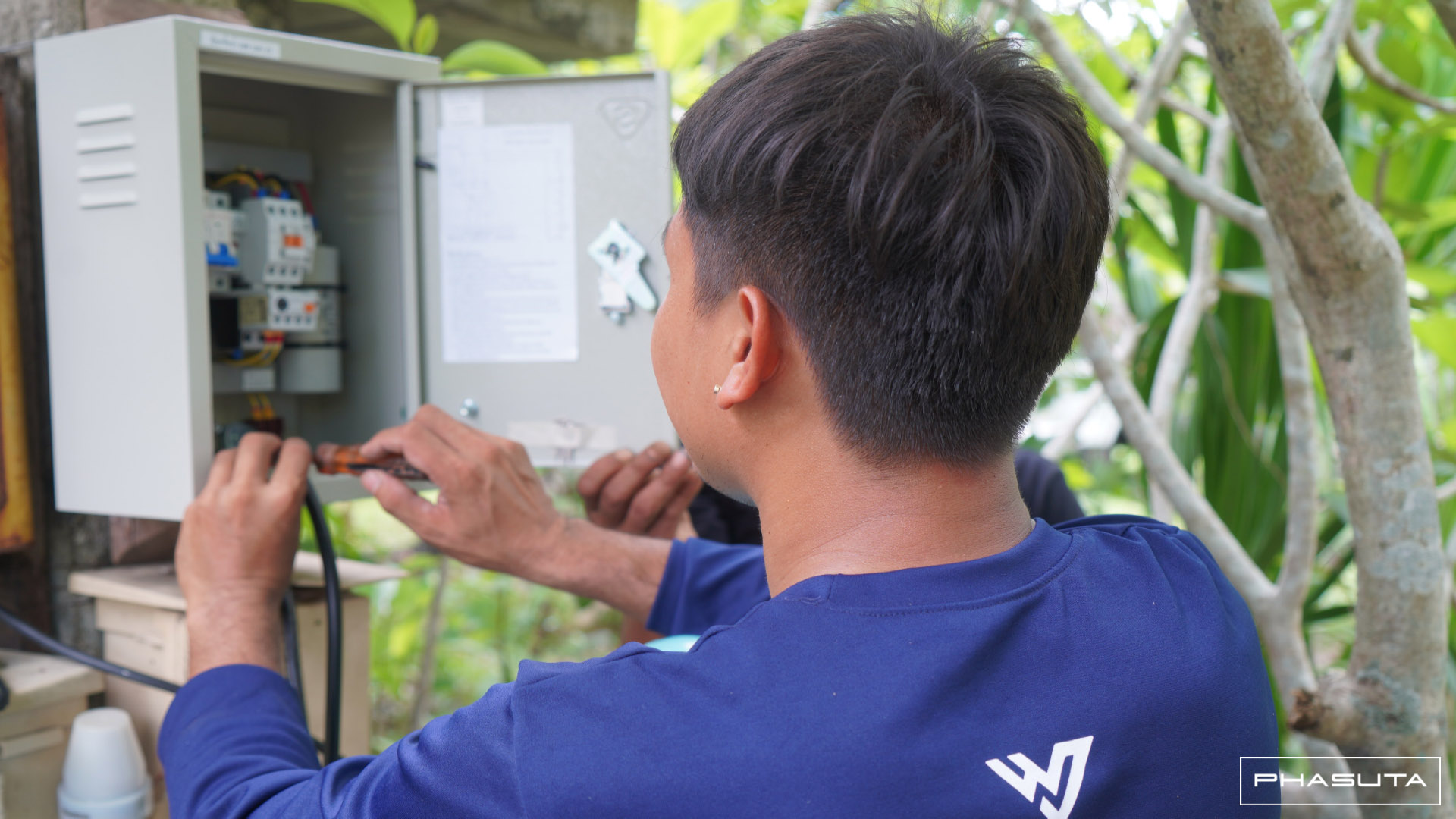
ช่างทุกคนตั้งใจทำงานและส่งมอบงานตรงเวลา
เครื่องมือทันสมัย
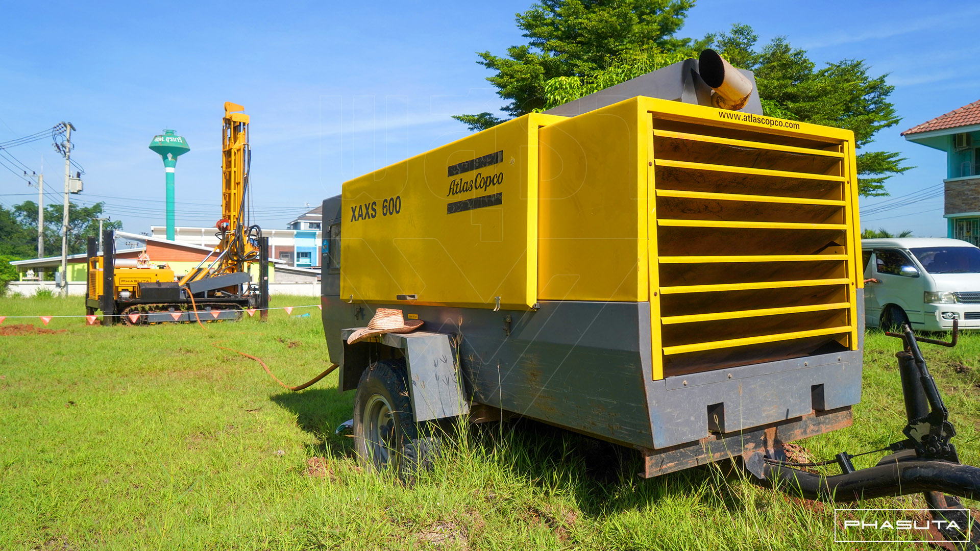
เราเลือกใช้เครื่องมือและอุปกรณ์ที่ทันสมัยและมีประสิทธิภาพสูง
รับประกันงาน
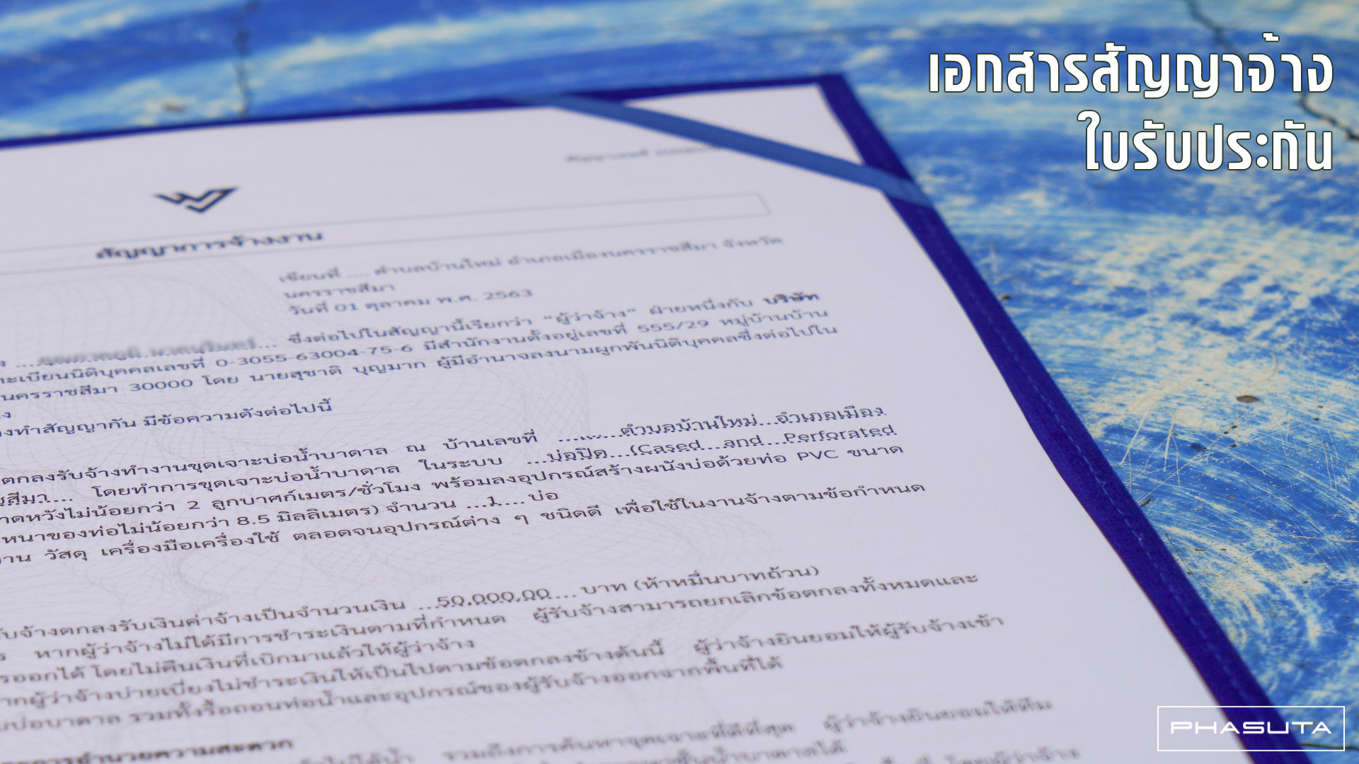
ออกเอกสารสัญญาที่ชัดเจนเป็นธรรมและรับประกันผลงาน
ความน่าเชื่อถือ
บริษัทจดทะเบียนพาณิชย์ถูกต้องมีที่ตั้งสำนักงานชัดเจน
บริการหลังการขายที่ดี
ใส่ใจลูกค้าทั้งรายเล็ก-รายใหญ่ ดูแลทั้งลูกค้าเก่า-ลูกค้าใหม่ และยังดูแลความช่วยเหลือแม้หมดประกันแล้ว
ซื่อสัตย์และจริงใจกับลูกค้า
เลือกใช้แต่ของและอุปกรณ์คุณภาพดี งานตรงสเป็ค-ไม่หมกเม็ด
มีความรับผิดชอบ
ช่างทุกคนตั้งใจทำงานและส่งมอบงานตรงเวลา
เครื่องมือทันสมัย
เราเลือกใช้เครื่องมือและอุปกรณ์ที่ทันสมัยและมีประสิทธิภาพสูง
ออกเอกสารสัญญาที่ชัดเจนเป็นธรรมและรับประกันผลงาน
ออกเอกสารสัญญาที่ชัดเจนเป็นธรรมและรับประกันผลงาน
ความน่าเชื่อถือ
บริษัทจดทะเบียนพาณิชย์ถูกต้องมีที่ตั้งสำนักงานชัดเจน
บริการหลังการขายที่ดี
ใส่ใจลูกค้าทั้งรายเล็ก-รายใหญ่ ดูแลทั้งลูกค้าเก่า-ลูกค้าใหม่ และยังดูแลความช่วยเหลือแม้หมดประกันแล้ว
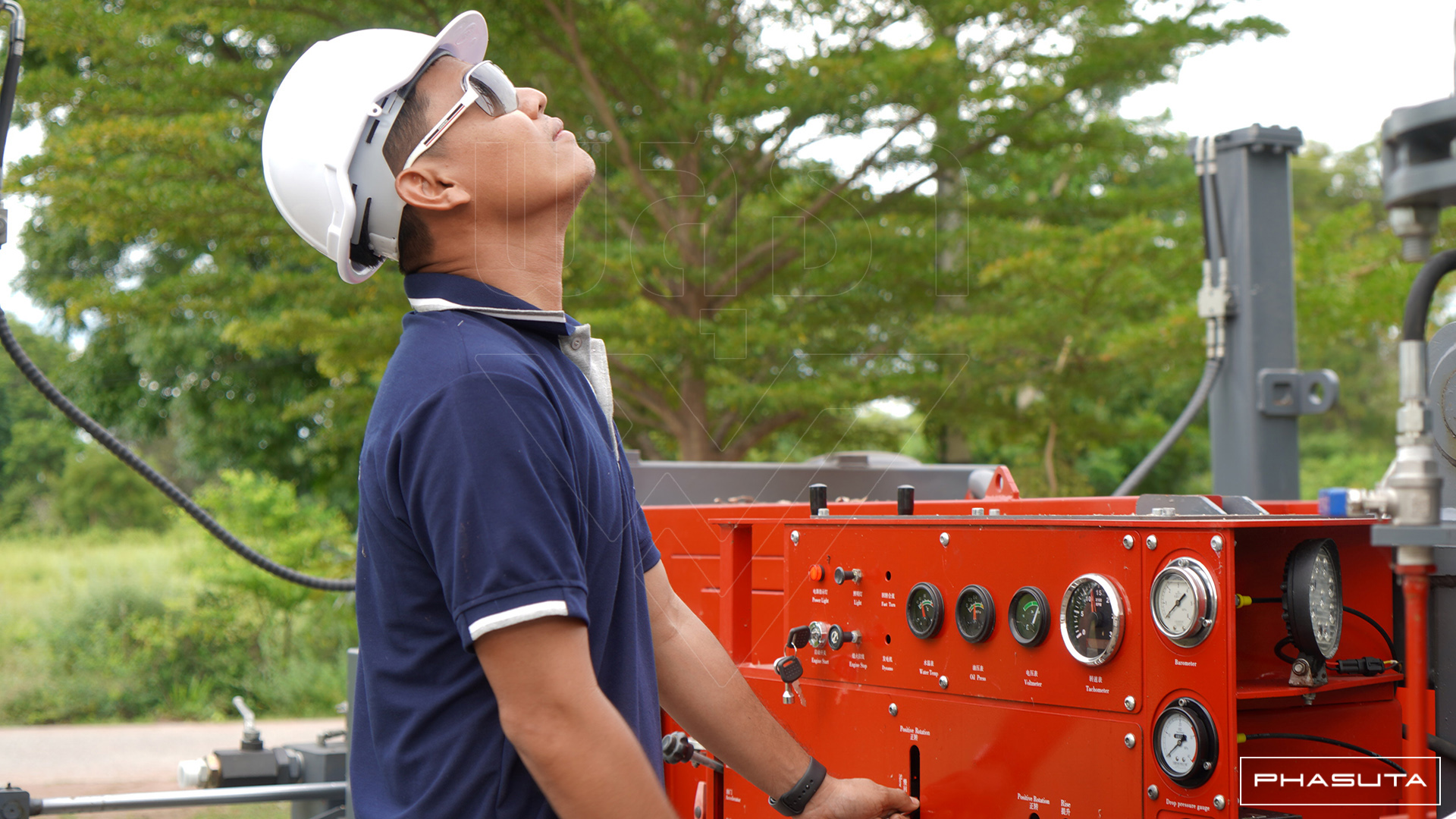
ตัวอย่างผลงาน
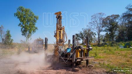
งานเจาะบ่อบาดาลในพื้นที่ราบสูงของตำบลวะตะแบก อำเภอเทพสถิต จ.ชัยภูมิ
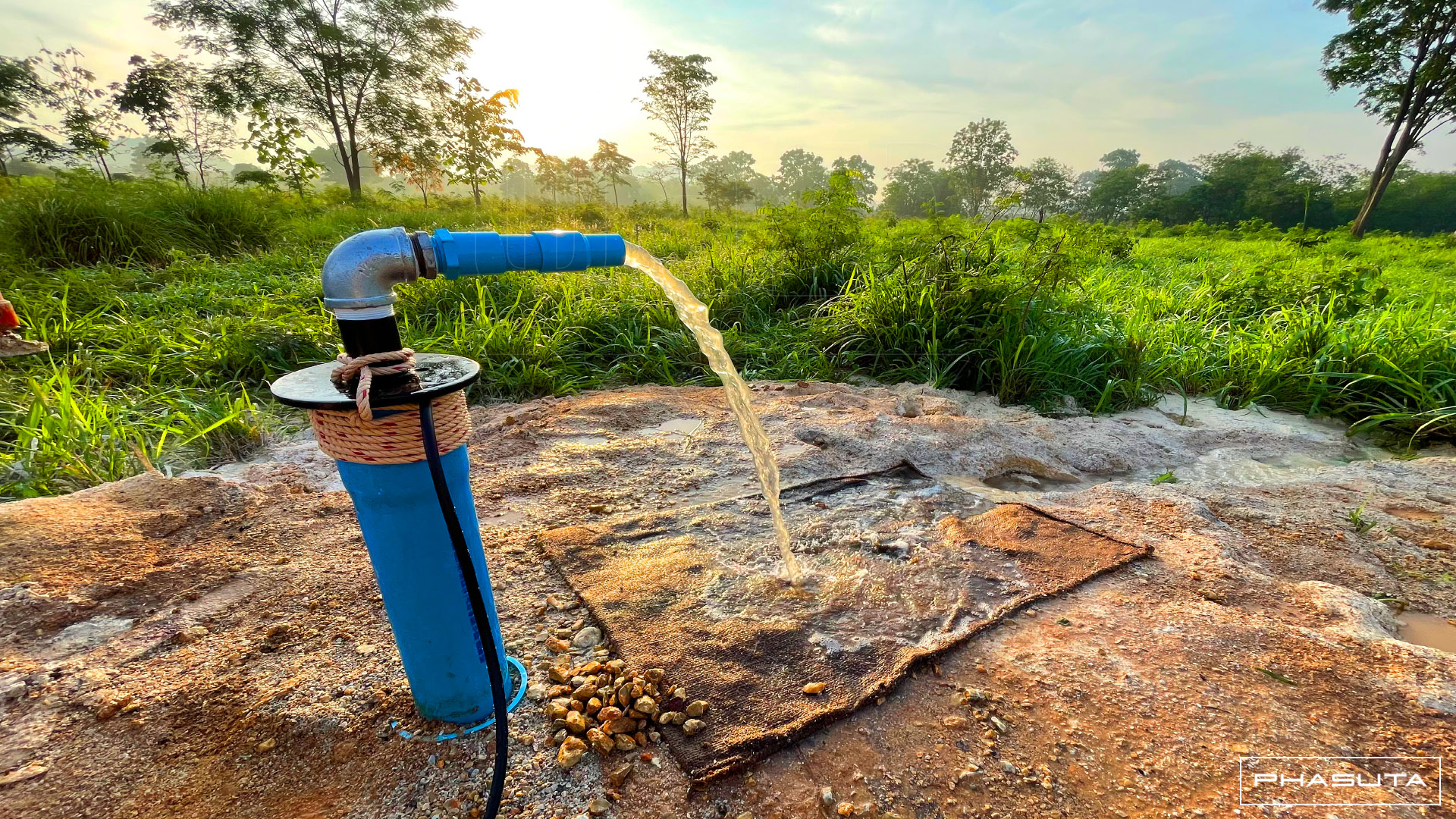
งานเจาะบ่อบาดาลในพื้นที่ราบสูงของตำบลวะตะแบก อำเภอเทพสถิต จ.ชัยภูมิ พื้นที่ตั้งอยู่สูงจากระดับน้ำทะเลกว่า 300 เมตร โดยตั้งเขตอุทธรณีชั้นหินอุ้มน้ำหินชุดเสาขัว ซึ่งเป็นธรณีที่ประกอบด้วยหินตะกอน (Sedimentary Rocks) หินทราย หินทรายแป้งเนื้อปนไมกา เม็ดปูนและเม็ดซิลิกา โดยพื้นที่ส่วนใหญ่เป็นเนินสูงและมีความลาดเอียง จึงทำให้พื้นที่นี้มีประมาณน้ำบาดาลสะสมค่อนข้างต่ำ ทำให้การค้นหาและเจาะบาดาลทำได้ยากลำบาก
Drilling of artesian wells in the highlands of Watabaek Subdistrict, Thep Sathit District, Chaiyaphum Province, the area is located at an altitude of more than 300 meters above sea level, by setting up a geologic basin of Sao Khua series which is a geology that consists of sedimentary rocks of sandstone, siltstone with mica Granules and Silica Granules. Most of the area is hilly and sloping. Therefore, this area has a relatively low estimation of accumulated groundwater. This made it difficult to find and penetrate the well.
ก่อนการดำเนินการขุดเจาะ ทีมงานพสุธาทุ่มเทเวลากับการสำรวจ Electrical Resistivity Method (ERM) หลายสิบจุด ก่อนเลือกพื้นที่เจาะที่เหมาะสมและดำเนินการเจาะบ่อบาดาลอย่างแม่นยำ จนสามารถสร้างบ่อบาดาลที่มีความสามารถในการผลิตน้ำสะอาดได้เต็มศักยภาพของพื้นที่ฯ
Prior to drilling operations, our team devoted a lot of time to dozens of Electrical Resistivity Method (ERM) surveys before selecting the appropriate drilling site and conducting accurate well drilling. until the creation of an artesian well capable of producing groundwater to the full potential of the area. ชมผลงาน
Open Hole Completion
150 ม.
ลึก
Drilling of artesian wells in the highlands of Watabaek Subdistrict, Thep Sathit District, Chaiyaphum Province, the area is located at an altitude of more than 300 meters above sea level, by setting up a geologic basin of Sao Khua series which is a geology that consists of sedimentary rocks of sandstone, siltstone with mica Granules and Silica Granules. Most of the area is hilly and sloping. Therefore, this area has a relatively low estimation of accumulated groundwater. This made it difficult to find and penetrate the well.
ก่อนการดำเนินการขุดเจาะ ทีมงานพสุธาทุ่มเทเวลากับการสำรวจ Electrical Resistivity Method (ERM) หลายสิบจุด ก่อนเลือกพื้นที่เจาะที่เหมาะสมและดำเนินการเจาะบ่อบาดาลอย่างแม่นยำ จนสามารถสร้างบ่อบาดาลที่มีความสามารถในการผลิตน้ำสะอาดได้เต็มศักยภาพของพื้นที่ฯ
Prior to drilling operations, our team devoted a lot of time to dozens of Electrical Resistivity Method (ERM) surveys before selecting the appropriate drilling site and conducting accurate well drilling. until the creation of an artesian well capable of producing groundwater to the full potential of the area. ชมผลงาน
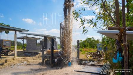
งานขุดเจาะบาดาลเพื่อการใช้งานในครัวเรือน อำเภอพัฒนานิคม ลพบุรี
งานเจาะบ่อบาดาลในอำเภอพัฒนานิคม จ.ลพบุรี โดยพื้นที่ตั้งอยู่เขตอุทกธรณีชั้นหินอุ้มน้ำหินคาร์บอเนตอายุเพอร์เมียน ซึ่งเป็นโซนที่เจาะบาดาลได้ยากพื้นที่หนึ่ง เนื่องจากธรณีเป็นชั้นหินแข็งหลากหลายชนิด ไม่ว่าจะเป็นหินปูนและหินแกรนิต และมีชั้นตะกอนดินผสมเศษหินภูเขาสลับกับชั้นทรายและดินเหนียว ผู้ควบคุมการเจาะจำเป็นต้องใช้ทักษะและความสมาธิในการควบคุมความเร็วในการเจาะและปริมาณลมให้เหมาะสม
Drilling of artesian wells in Phatthana Nikhom District, Lopburi Province. The area is located in the aquifers hydrogeological zone, the carbonate rocks of the Permian age. This is a zone that is difficult to drill groundwater because the geology is a variety of hard rock layers, whether it is limestone and granite and there is a layer of sediment mixed with mountain rock rubble alternating with sand and clay layers. Drill operators need skill and concentration to properly control drilling speed and airflow. ชมผลงาน
Cased and Perforated Completion
60 ม.
ลึก
Drilling of artesian wells in Phatthana Nikhom District, Lopburi Province. The area is located in the aquifers hydrogeological zone, the carbonate rocks of the Permian age. This is a zone that is difficult to drill groundwater because the geology is a variety of hard rock layers, whether it is limestone and granite and there is a layer of sediment mixed with mountain rock rubble alternating with sand and clay layers. Drill operators need skill and concentration to properly control drilling speed and airflow. ชมผลงาน
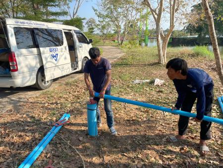
ติดตั้งปั้มน้ำบาดาลจังหวัดนครสวรรค์
ติดตั้งปั้มน้ำบาดาลให้กับเทศบาลเมืองชุมแสง อำเภอชุมแสง จังหวัดนครสวรรค์
ชมผลงาน
Cased and Perforated Completion
ม.
ลึก
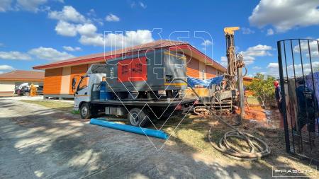
งานขุดเจาะบ่อบาดาลเพื่อการใช้งานในครัวเรือน อ.บัวลาย จ.นครราชสีมา
งานขุดเจาะบ่อบาดาลเพื่อการใช้งานในครัวเรือน บ้านวังโพน ต.บัวลาย อ.บัวลาย เน้นการสร้างบ่อบาดาลคุณภาพดีพร้อมออกแบบและติดตั้งระบบการใช้น้ำภาพในบ้านของลูกค้า
ชมผลงาน
Cased and Perforated Completion
60 ม.
ลึก
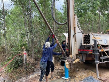
งานขุดเจาะบ่อบาดาลเพื่อการใช้งานเกษตรและครัวเรือน อ.กบินทร์บุรี จ.ปราจีนบุรี
งานขุดเจาะบ่อบาดาลเพื่อการใช้งานเกษตรและครัวเรือน ต.ลาดตะเคียน อ.กบินทร์บุรี จ.ปราจีนบุรี เป็นพื้นที่ที่มีปริมาณน้ำบาดาลและคุณภาพอยู่ในเกณฑ์ดี หน้างานบริเวณผิวดินเป็นดินลูกรังที่มีความโปรงตัว ลึกลงไปเป็นชั้นหินอุ้มน้ำหินชั้นกึ่งแปรอายุเพอร์เมียนคาร์บอนิเฟอรัส ประกอบด้วยชั้นหินตะกอน หินทราย หินเกรย์แวก สีเทาแกมเขียว หินกรวดมน และหินปูนแทรกเป็นเลนซ์ จากการสำรวจตรวจพบโครงสร้างโพรงน้ำบาดาล aquifer bedrock กระจายในความลึก 60-100 เมตร โดยมีปริมาณน้ำบาดาลไม่ต่ำกว่า 40 ลบ.ม./ชั่วโมง
Drilling of groundwater wells for agricultural and household use, Lat Takhian Subdistrict, Kabin Buri District, Prachin Buri Province, is an area with good groundwater quality and supply.
The soil surface is laterite soil that has a sheer but deep down to become aquifers, semi-permian carboniferous aquifers. It consists of sedimentary rock, sandstone, grey-wax, greenish-gray, rounded pebbles and interlaced limestone. According to the survey, the aquifer bedrock was found spreading at a depth of 60-100 meters with a groundwater volume of not less than 40 cubic meters/hour. ชมผลงาน
Cased and Perforated Completion
70 ม.
ลึก
Drilling of groundwater wells for agricultural and household use, Lat Takhian Subdistrict, Kabin Buri District, Prachin Buri Province, is an area with good groundwater quality and supply.
The soil surface is laterite soil that has a sheer but deep down to become aquifers, semi-permian carboniferous aquifers. It consists of sedimentary rock, sandstone, grey-wax, greenish-gray, rounded pebbles and interlaced limestone. According to the survey, the aquifer bedrock was found spreading at a depth of 60-100 meters with a groundwater volume of not less than 40 cubic meters/hour. ชมผลงาน
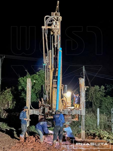
งานขุดเจาะบาดาลเพื่อการใช้งานในครัวเรือน อ.สีดา จ.นครราชสีมา
พิกัดขุดเจาะบ่อบาดาลตั้งอยู่ในเขตเป็นพื้นที่ที่มีน้ำบาดาลอยู่น้อย ชั้นอุทกธรณีกลุ่มชั้นหินอุ้มน้ำหินชุดมหาสารคาม ประกอบด้วยชั้นหินตะกอน (Sedimentary rocks) หินโคลน หินทรายแป้ง และหินทราย ซึ่งเป็นกลุ่มหินที่มีโครงสร้างไม่แข็งแรงพอที่จะสร้างบ่อบาดาลแบบ Open Hole ทีมงานจึงดำเนินการสร้างบ่อบาดาลแบบถาวรเพื่อให้บ่อบาดาลมีอายุการใช้งานที่ยาวนาน
ชมผลงาน
Cased and Perforated Completion
50 ม.
ลึก
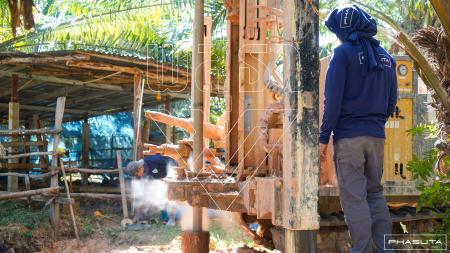
งานขุดเจาะบ่อบาดาลเพื่อการเกษตร อ.พิมาย จ.นครราชสีมา
งานขุดเจาะบ่อบาดาลเพื่อการเกษตร ต.โบสถ์ อ.พิมาย จ.นครราชสีมา ซึ่งเป็นพื้นที่ที่สามารถเจาะบาดาลได้น้ำจืดคุณภาพดี โดยตั้งอยู่ในเขตชั้นอุทกธรณีอยู่ในเขตหินชุดมหาสารคาม ประกอบด้วยตะกอนที่ยังไม่จับกันแข็ง (Sediments) ตะกอนตะพักลำน้ำ: ทราย กรวด ศิลาแลง และลูกรัง
Groundwater Well Drilling for agriculture at Bot Subdistrict, Phimai District, Nakhon Ratchasima Province, which is an area where the well can be drilled with good quality fresh water. It is located in the hydro-geological layer in the Maha Sarakham Rock formation area. Consists of sediments: sand, gravel, laterite and gravel.
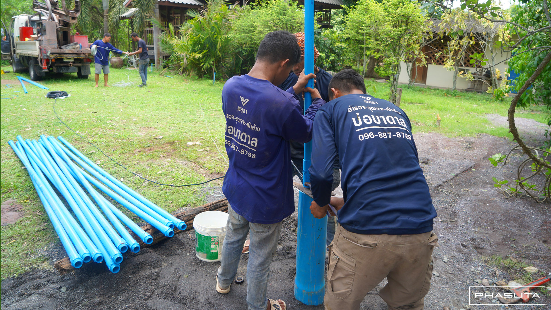
เพื่อให้บ่อบาดาลมีความแข็งแรงและมีอายุการใช้งานที่ยาวนาน ช่างบาดาลจึงมีสร้างบ่อแบบมาตราฐานโดยการกรุบ่อด้วยท่อกันพังสุดถึงก้นบ่อ
Then to make artesian wells provide a long service life. Our technicians build a standard Cased & Perforated Well Completion. ชมผลงาน
Cased and Perforated Completion
60 ม.
ลึก
Groundwater Well Drilling for agriculture at Bot Subdistrict, Phimai District, Nakhon Ratchasima Province, which is an area where the well can be drilled with good quality fresh water. It is located in the hydro-geological layer in the Maha Sarakham Rock formation area. Consists of sediments: sand, gravel, laterite and gravel.
เพื่อให้บ่อบาดาลมีความแข็งแรงและมีอายุการใช้งานที่ยาวนาน ช่างบาดาลจึงมีสร้างบ่อแบบมาตราฐานโดยการกรุบ่อด้วยท่อกันพังสุดถึงก้นบ่อ
Then to make artesian wells provide a long service life. Our technicians build a standard Cased & Perforated Well Completion. ชมผลงาน
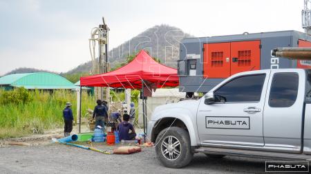
งานเจาะบาดาลเพื่อใช้ในภาคธุรกิจ อำเภอเมืองลพบุรี จ.ลพบุรี
งานเจาะบาดาลในเขตตำบลนิคมสร้างตนเอง อำเภอเมืองลพบุรี จ.ลพบุรี ชั้นอุทกธรณีตั้งอยู่ในชั้นหินอุ้มน้ำหินคาร์บอเนตอายุเพอร์เมียน โดยชั้นดินส่วนบนเป็นตะกอนดินโคลนและทรายละเอียดจำเป็นต้องเจาะด้วยระบบน้ำเวียนไปจนถึงชั้นธรณีที่เป็นหินแข็งจึงเจาะต่อด้วยระบบลมกระแทกผ่านชั้นหินหลากหลายชนิด (หินปูน หินแกรนิต ฯลฯ) ให้ถึงชั้นหินอุ้มน้ำที่มีความสะอาดและมีปริมาณเหมาะสมต่อการสูบใช้งานในเชิงพาณิชย์
The hydrogeological layer that exists in Permian carbonate aquifers. Mud Rotary and Reverse Circulation drilling are required because the upper soil surface is sedimentary, mud, and fine sand. Drilling continues with the Air Drilling through several rock layers (limestone, granite, etc.) until it reaches aquifers that are clean and massive enough for commercial use. ชมผลงาน
Cased and Perforated Completion
60 ม.
ลึก
The hydrogeological layer that exists in Permian carbonate aquifers. Mud Rotary and Reverse Circulation drilling are required because the upper soil surface is sedimentary, mud, and fine sand. Drilling continues with the Air Drilling through several rock layers (limestone, granite, etc.) until it reaches aquifers that are clean and massive enough for commercial use. ชมผลงาน
คู่ค้าภาครัฐ
บริษัท พสุธา ดีเวลลอปเม้นท์ จํากัด ได้พัฒนาสินค้าและบริการให้มีความเป็นมาตรฐานสำหรับจัดซื้อจัดจ้างกับภาครัฐ

45
ประสบการณ์
18
พนักงาน
1727
ลูกค้า
2327
โครงการ
ติดต่อ
ทีมงาน
มืออาชีพ
ประสิทธิภาพ
รับผิดชอบ
ฟอร์ม ติดต่อ
บริษัท พสุธา ดีเวลลอปเม้นท์ จํากัด
เลขที่ 11 ซอยบรมราชชนนี 73 ถนนบรมราชชนนี แขวงฉิมพลี เขตตลิ่งชัน กรุงเทพมหานคร 10170
อีเมล์
เวลาทำการ จันทร์-เสาร์ 9:00-18:00 น.
โทร
ฝ่ายบริการ/ช่าง: 096-887-8788


